#Matthew
We'll update you about the storm's impact on Ocracoke on Sunday morning. Until then, here are a few warnings and helpful tips from the social media posts from local agencies. Stay safe, peeps!

NCDOT Highway 12: No travel issues along N.C. 12 at this point. There will be heavy rain and wind this evening and tonight, so please don't travel unless you have to. Given the path of the storm, we do anticipate some issues on Hatteras Island and Ocracoke and have staged equipment at those locations. We'll give you an update in the morning, unless something changes before then.
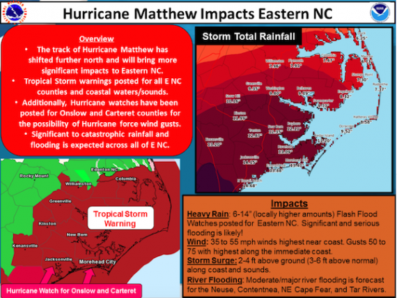
Hyde County Emergency Management: Matthew's structure is evolving and becoming elongated with some extra-tropical like characteristics. With that development, there is a slight chance of hurricane strength winds on the back side of the storm. Given the potential, the NWS has decided to extend a Hurricane Watch all the way up the coast to Duck to coincide with the Tropical Storm Warning. The timing of the stronger winds could be just before daybreak. Residents need to be aware of this potential and wait for conditions to subside before assessing the damage, as trees may be downed during this period.
Tideland EMC: The rumors are NOT true. Tideland has no plans to shut power off in advance of bad weather and no plans to shut power off at midnight. We don't know how these rumors get started but please help us dispel them. We can expect deteriorating conditions between now and 2 am. Rather than report outages via Facebook we ask you to call 800.882.1001 so your outage can be logged into our outage management system. As the evening progresses we will continue to post to Facebook and Twitter and you can monitor outages here: http://74.122.16.101:83/
There was a small, isolated outage on Ocracoke, when a transformer blew. 12 meters were temporarily without power. Crews were dispatched and fixed it fast. Ocracokers were grateful.


