Swirling Waters

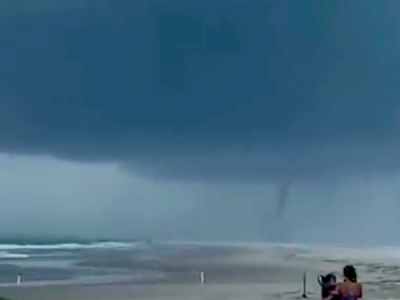
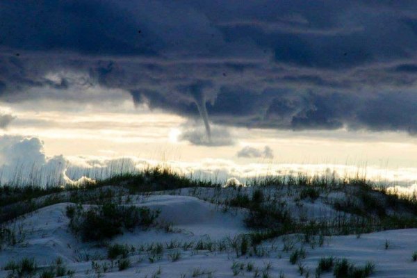
What was this event? A waterspout! While seeing waterspouts around these parts isn’t unheard of, it’s not like they form every day. Or, if they do form every day, it’s not within our range of sight. The official definition of a waterspout iiisss: a rotating column of water and spray formed by a whirlwind occurring over the sea or other body of water. It’s a tornado, essentially. There are two types of waterspouts: tornadic (shocking, I know) and fair weather.
NOAA describes tornadic waterspouts as, “…tornadoes that form over water or move from land to water.” Tornadic waterspouts form due to severe weather and are often accompanied by dangerous lighting, high winds, rough seas, and large hail. These whirlwinds form due to hot and cold air meeting and swirling, and the funnel formation descends from the thunderstorm to the water. According to the National Weather Service, most tornadic waterspouts begin over land and move to water. The NWS will issue tornado warnings if severe weather conditions require it, so if you’re near water during a watch or warning, you could very well see a tornadic waterspout. Now I’m not advocating people become brazen and proclaim themselves as storm chasers; tornadic waterspouts can cause injury and damages, after all, so it’s best to move at a 90-degree angle away from anything remotely shaped like a funnel. I’ve been caught on the beach during severe weather and let me tell you, it is un-fun. Seeking shelter in the dunes has always been my only option since I don’t have a beach vehicle to make a quick escape. Once, when I was on the beach testing out a new camera, I witnessed the early stages of a tornadic waterspout. I later learned residents and visitors dining at SmacNally’s reported that it was very near them, indicating it formed on the Pamlico Sound side of the island, though I’m not sure if it formed over land or water. It dissipated quickly and did not cause any injury or damages.

The other type of watery funnel cloud is called a fair weather waterspout. Fair weather waterspouts occur, as described by NOAA, when there’s a, “…dark flat base of a line of developing cumulus clouds.” What is a cumulus cloud? We non-meteorologists often describe cumulus clouds as being fluffy and cotton-ball-like, but one easy way to spot them is to look for that flat base. Fair weather waterspouts aren’t generally associated with thunderstorms (hence all that “fair weather” business) and form over open water, in high-humidity, and ascend towards the clouds. These spouts generally don’t move very much and they don’t have much strength. Once fair weather waterspouts come in contact with land they generally dissipate quickly.
The National Weather Service will issue tornado and waterspout watches and warnings (they issues these for all kinds of severe weather) if conditions appear optimal for their formation. A tornado watch indicates conditions are favorable for tornadoes to form; a tornado warning indicates severe weather has developed and radar has shown low-level cloud rotation and tornado formation is likely. Severe weather, warm and cold fronts meeting, or cold fronts moving quickly over warm water are several things scientists look before issuing warnings and watches. Tornado warnings generally apply to specific areas, whereas waterspouts warnings apply to large areas since it is not unusual for multiple waterspouts to form at the same time over a large area. Quite often, the NWS releases warnings thanks to reports of tornadic activity spotted by law enforcement equipment.
In general, as reported by the NWS, waterspouts that make landfall are not nearly as powerful as tornadoes; they cause little or no damage and typically dissipate quickly. When these funnel clouds are likely to form, the NWS will issue a Severe Weather Statement. If weather conditions could create severe and powerful waterspouts, the NWS will issue a Tornado Warning.
As with all severe weather, the National Weather Service suggests removing yourself from the direct path of storms. If you’re on a boat you could potentially be in grave danger, especially if a tornadic waterspout forms, so it’s best to seek safe harbor as quickly as possible. If you’re on land, the NWS urges people to leave the area or seek shelter wherever you can.
Mother Nature sure has some neat tricks up her sleeve. Observe those tricks responsibly, or do like I do and hunker down in the sand dunes.


