This is the second recent guided tour – the first was last Saturday afternoon.
Nestled away from the "main drag," a short walk from the Lighthouse will lead you onto the one-way road that will take you to the entrance of Springer's Point, a beautiful nature preserve protected by the North Carolina Coastal Land Trust. The preserve has no vehicle parking, but does offer a sizeable bike rack for those who wish to peddle to the park instead of walk. The trail is unpaved and lined with dense vegetation. Tree roots protrude through the sandy path, and leaves are scattered all around. The trees and foliage that make up this Maritime forest help protect walkers and animals from the wind, but they also allow insects easy flying and easy biting.
As the trail winds through the maritime forest you'll notice tiny wooden stands. When you flip up the lids you'll see information about and photographs of all the various plants that thrive in the salty, diverse conditions common to a barrier island, as well as memorials to residents, an old cistern, and intricate carvings done by one of the groundskeepers, Len Skinner.
The large live oak trees have long branches that wind and bend like something out of a fairy tale, and when the sun shines through the leaves a brilliant green is produced, almost like a stained-glass window. Birds can be heard chirping and tweeting through the thick canopy, and, if you're lucky, you may get spot some of the various song birds that have made the area their home.
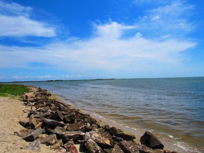
The trail slightly ascends and descends a few times, and you'll come to one intersection. I typically stay to the left to make my way to the beach, but you can veer to the right if you so choose. You may have to bend down to avoid getting caught by the low-hanging branches as you make your way out of the forest down toward the water on the final descent. The scenery abruptly changes; not only will the sun be blinding after being shaded for so long, but the forest stops and you're presented with the Pamlico Sound directly to your front. The southern most tip of Ocracoke is visible to your left, and as you follow the sandy trail around the forest you'll come to a small beach area. Now, the forest is to your right, and the Ocracoke Lighthouse is directly in front of you. There's a sign indicating how to return to the trail, and on your way back you'll pass by some pieces of Ocracoke history.
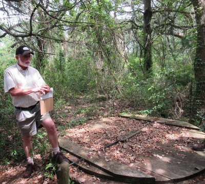
Eighth-generation islander, local historian, and businessman Philip Howard, along with representatives from the North Carolina Coastal Land Trust, hosted a guided walk through Springer's Point, allowing participants to listen to stories and learn some details about Ocracoke's rich history. We met at the head of the trail and were given a wonderful introduction before walking to our next destination.
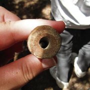
Many people describe Ocracoke as a "traditional fishing village," and while that may be applicable to the small community within the past 100 years, that wasn't always the case. Artifacts have been found in the water around Springer's Point indicating that Native Americans and animals not seen here once had a presence on Ocracoke. Two types of pipe were found by Philip; one was made by Native Americans, another by English colonists. He also found what was orginally thought to be an old horse's tooth. Further investigation led Philip to discover it was actually a fossilized bison tooth, dating back at least 10,000 years.
From here, we continued along the trail and stopped at Sam Jones's and his horse's gravestones in order to hear more about Ocracoke (this is the intersection I was talking about. The group went to right on this walk). We talked briefly about Sam Jones and how eccentric he was, throwing lavish parties in large buildings (The Castle B&B and The Berkley Manor), and his love for his horse, Ikey D. When Ikey D died, Jones buried him in Springer's Point. Jones died in 1977 and was buried next to his beloved Ikey D.
Philip went on to tell us the current area where the village stands was once separate from the rest of Ocracoke Island and the entire Outer Banks chain. Rising sea levels and storms contributed to the two parts fusing together to form the island that we know today.
In 1715, the North Carolina General Assembly passed an Act allowing Pilots to live and work on the island, aiding ships as they traveled through Ocracoke Inlet. Many of the original residents stayed on Ocracoke for trade and commerce purposes; it wasn't until after Blackbeard's demise in 1718 that people really began permanently settling on the island.
In 1759, William Howard purchased the entire island, and over the course of many decades the island was sold to the Willliams family, back to the Howards, and then to the Tolson family. Daniel Tolson and his wife owned the property until his death in 1879. His widow sold the land to the Springer family and the area has been called "Springer's Point" since.
Until the Hurricane of 1846, Ocracoke Inlet was the main thoroughfare to mainland towns and ports. Fishing was practical for the residents themselves, but at the time the people had no way of keeping their catch fresh, so other forms of revenue were required. The storm of 1846 carved Hatteras Inlet and Oregon Inlet, and with those being bigger channels, demands changed over the next few decades (even though Hatteras Inlet and Oregon Inlet are still used, Ocracoke Inlet remains the only to remain open consistently since colonists began keeping records). Prior to the hurricane, many residents were Pilots on Ocracoke and Portsmouth Islands, and others became Mariners. Mariners built vessels and shipped goods to various destinations. The census of 1850 listed 27 Pilots, 10 mariners, and five fishermen between a total of 388 residents. The 1860 census totaled 426 residents, with 13 Pilots, 18 mariners, and 1 fisherman.
In 1883 the first United States Life Saving Station was established on Ocracoke, opening up new opportunities for residents. Philip told us there was evidence windmills were used, and the residents began creating roads and pathways to make walking through town easier and faster. In 1900, the census reported Ocracoke had 538 residents. Two were listed as Pilots, there were 17 Mariners, and 36 were listed as Fishermen. These fisherman were most likely oystermen and clammers, trying to recover from the Ocracoke Oyster War of 1890.
In 1890, a government agent came to Ocracoke and discovered mass quantities of oysters in the waters around the Island. This government agent decided to take advantage of this knowledge and gathered oysters in overwhelming numbers thanks to equipment capable of out-gathering the hand-held oystering tongs used by residents. The agent brought down extra men to help gather oysters, which were shipped all over the country, and when the residents had had enough they loaded up their boats and, carrying shot guns, confronted the agent and his men. The residents did end up being charged, but were eventually acquitted. The damage to the oyster beds was significant and long-lasting, and conflict continued over the next several years. Laws were eventually passed to protect oyster beds and the residents who worked the waters, but unfortunately, oyster populations had been depleted up and down the East Coast.
More unrest occurred when the Doxsee family moved their New York clam-canning business to Ocracoke and set up a warehouse operation in 1898. The family moved to Ocracoke after depleting the clams up north, and in the span of 12 years depleted the clams around Ocracoke so there were not enough to support a commercial operation. The warehouse is no longer standing, but when it did it was located along "The Ditch" directly across Silver Lake from NCCAT and the ferry docks.
In the 20th century, Ocracoke residents began a new type of business: hunting and fishing guides. Politicians and other well-to-do folks traveled to Ocracoke, so the natives led and taught them how to hunt and fish. The guiding business did quite well from about 1910 until the late 1930's. In 1938 a significant event occurred: electricity came to Ocracoke. Now the residents could make their own ice, which allowed them to ship fish to other destinations, and Ocracoke became a fishing village.
In 1942, a United States Naval Base was constructed on Ocracoke, which brought more people and diversity to the small community, and in 1950 the first ferry ran between Hatteras and Ocracoke Island. The state of North Carolina bought the ferry system and paved roads were completed on the Islands in 1957, but the real "boom" for the Outer Banks came when National Geographic published a story about the long island chain. That article propelled the Outer Banks into the spotlight and brought the tourist industry to the Islands.
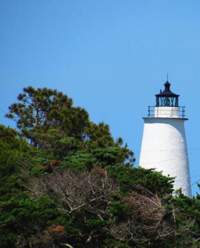
We were now just a short distance from the beach area, so we walked out of the Maritime forest. To our right was the Ocracoke Lighthouse, out front the Pamlico Sound. Side note: When you look at the Lighthouse you may notice the lamp room is off-centered. This is due to the way the original winding staircase was constructed along the interior wall of the structure, and also because of where the ladder and hatch to access the lamp room were built. The lamp room hatch can only be reached by climbing a small ladder, and the hatch must be pushed up while you climb into the lamp room. As you enter the lamp room, the Fresnel lens is to your front and slightly to the right.
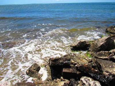
Large chunks of rock formed a jetty and barrier along the waterline to our left, and were placed intentionally to help prevent beach erosion in the area called "Teach's Hole." As we stood near the jetty, Philip told us about the final days of Blackbeard and some of the shenanigans (referred to as – this might make you blush – the Ocracoke Orgy) he and his fellow pirates participated in while hiding from the British Royal Navy. The British Royal Navy did find Blackbeard and his men here on Ocracoke, and got into a battle just offshore in Teach's Hole in November of 1718. Lieutenant Robert Maynard and Blackbeard engaged in hand-to-hand combat, and Blackbeard was finally killed after receiving 25 wounds from Maynard. Blackbeard's head was then cut off and put on display on Maynard's ship, and later in Virginia. His headless body was thrown overboard where it is said to have swum around the vessel seven times before sinking. His head was reportedly stolen, cleaned, silver-plated, and turned into a punch bowl. The skull/punch bowl was supposedly used in North Carolina, and disappeared and reappeared several times over the course of the past several centuries. The silver-plated skull is now kept in the Peabody-Essex Museum in Salem, Massachusetts.
After Philip's walk and talk came to a close, we were led to another part of the beach where the North Carolina Coastal Land Trust is currently attempting to rehabilitate and stabilize the shoreline. Volunteers from the Ocracoke community, state colleges, NC Coastal Land Trust, and fishermen all participated in developing and placing bags full of oyster shells along the waterline. Some have stayed intact, others have broken. The NC Coastal Trust will return this week to continue its work and hopes the bags will hold to create a sustainable barrier against the water. The organization also planted native salt marsh grasses, which are flourishing.
To read more about Daniel Tolson, the Ocracoke Oyster Wars, Sam Jones and Ikey D, the Ocracoke Orgy, Springer's Point, and Ocracoke history in general, check out the Village Craftsmen blog and monthly newsletter published online by Philip Howard.
